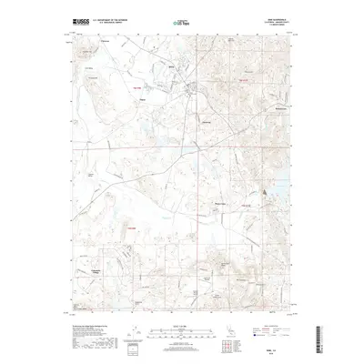
2018 Map of Ione
USGS Topo · Published 2018About this map
Ione anchors this California landscape as it transitions from the industrial pockets of Firebrick and Dagon to the agrarian stretches of the Ione Valley. The mapping details a complex network of water management essential to the region, including the Ione Canal, Preston Reservoir, and the Isaac Ditch, which redirect flow toward Lake Amador and Jackson Cr. This modern survey illustrates the proximity of historical burial grounds, such as the Ione Public Cem and Ione Catholic Cem, to evolving residential developments like Camanche Village. The terrain is defined by several prominent gulches and hills, notably China Gulch, Grapevine Gulch, and the Buena Vista Peaks. Further south, the map documents the influence of small-scale aviation with the Howard Private Airport and the recreational layout of the Camanche Skypark near Buena Vista.
Find a feature on this map
85 named features on this map. Tap any name to fly to it.
Don’t see what you’re looking for? This feature index may not catch every label — zoom into the map to look around manually.
Map Details
Editions of this 2018 Ione Map
This is the sole edition of this map. No revisions or reprints were ever made.
Other maps of this area

1889 · Jackson
USGS Topo · 1:125,000

1892 · Jackson
USGS Topo · 1:125,000

1894 · Lodi
USGS Topo · 1:125,000

1897 · Jackson
USGS Topo · 1:125,000

1902 · Jackson
USGS Topo · 1:125,000

1909 · Carbondale
USGS Topo · 1:31,680

1909 · Goose Creek
USGS Topo · 1:31,680

1909 · Clements
USGS Topo · 1:31,680
1939 · Bellota
USGS Topo · 1:62,500

1941 · Sutter Creek
USGS Topo · 1:62,500