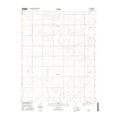
2017 Map of Ione
USGS Topo · Published 2017About this map
The settlement of Ione serves as a quiet focal point in this high-plains landscape of northern New Mexico, situated within Union County. The area is defined by a sparse but vital network of water sources, including the localized Entrania Spring and the drainage systems of Bob Wells Creek and Minneosa Creek. The land is divided by a traditional grid of county roads such as Ione Road and Britt Road, reflecting the expansive ranching and agricultural tracts common to this part of the state. These thoroughfares connect isolated homesteads and grazing lands, tracing the natural contours where Entrania Creek and the North Fork Minneosa Creek cut through the terrain. The map captures the enduring character of a rural community where the placement of a spring or the intersection of two gravel roads remains a primary landmark for local navigation and history.
Find a feature on this map
20 named features on this map. Tap any name to fly to it.
Don’t see what you’re looking for? This feature index may not catch every label — zoom into the map to look around manually.
Map Details
Editions of this 2017 Ione Map
This is the sole edition of this map. No revisions or reprints were ever made.
Other maps of this area
1954 · Tucumcari
USGS Topo · 1:250,000
1958 · Tucumcari
USGS Topo · 1:250,000
1966 · Rosebud
USGS Topo · 1:24,000
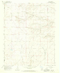
1966 · Ione
USGS Topo · 1:24,000
1966 · Hayden
USGS Topo · 1:24,000
1966 · Cherokee Valley
USGS Topo · 1:24,000
1966 · Cottonwood Springs
USGS Topo · 1:24,000
1966 · Mc Cloy Ranch
USGS Topo · 1:24,000
1971 · Kerlin Hill
USGS Topo · 1:24,000
1971 · Centerville Corner
USGS Topo · 1:24,000