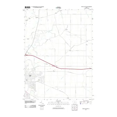
2010 Map of Iowa City East
USGS Topo · Published 2010About this map
Iowa City expands into its eastern rural surroundings on this 2010 survey, showing the transition from urban neighborhoods to the agricultural landscapes of Johnson County. The map provides significant genealogical value through its documentation of numerous small burial grounds including the Brick Chapel Cemetery, Molback Farm Cemetery, and Saint Marys Cemetery. These sites, often located near minor settlements like Newport and Elmira, offer a clear view of the area's early settlement patterns.
Find a feature on this map
55 named features on this map. Tap any name to fly to it.
Don’t see what you’re looking for? This feature index may not catch every label — zoom into the map to look around manually.
Map Details
Editions of this 2010 Iowa City East Map
This is the sole edition of this map. No revisions or reprints were ever made.
Other maps of this area

1887 · Cedar Rapids
USGS Topo · 1:62,500

1891 · Mechanicsville
USGS Topo · 1:62,500

1891 · Cedar Rapids
USGS Topo · 1:62,500

1891 · Iowa City
USGS Topo · 1:62,500

1894 · Mechanicsville
USGS Topo · 1:62,500

1894 · West Liberty
USGS Topo · 1:62,500

1901 · Stanwood
USGS Topo · 1:125,000

1903 · Fairfax
USGS Topo · 1:125,000

1938 · Iowa City
USGS Topo · 1:62,500

1958 · Davenport
USGS Topo · 1:250,000