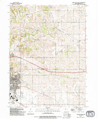
1993 Map of Iowa City East
USGS Topo · Published 1994About this map
Iowa City serves as the focal point for this eastern Johnson County landscape, which transitions from dense residential development to the agricultural patterns of the rural interior. Modern infrastructure like Interchange 246 and Interchange 249 along the interstate corridors defines the southern edge of the sheet, while the historical imprint of the Old Railroad Grade remains visible cutting through the terrain toward Elmira.
Find a feature on this map
31 named features on this map. Tap any name to fly to it.
Don’t see what you’re looking for? This feature index may not catch every label — zoom into the map to look around manually.
Map Details
Editions of this 1993 Iowa City East Map
This is the sole edition of this map. No revisions or reprints were ever made.
Other maps of this area

1887 · Cedar Rapids
USGS Topo · 1:62,500

1891 · Mechanicsville
USGS Topo · 1:62,500

1891 · Cedar Rapids
USGS Topo · 1:62,500

1891 · Iowa City
USGS Topo · 1:62,500

1894 · Mechanicsville
USGS Topo · 1:62,500

1894 · West Liberty
USGS Topo · 1:62,500

1901 · Stanwood
USGS Topo · 1:125,000

1903 · Fairfax
USGS Topo · 1:125,000

1938 · Iowa City
USGS Topo · 1:62,500

1958 · Davenport
USGS Topo · 1:250,000