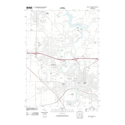
2010 Map of Iowa City West
USGS Topo · Published 2010About this map
The Iowa River carves a central path through this survey, anchoring the urban development of Iowa City and Coralville. The northern reaches of the map are defined by the Coralville Lake reservoir, formed by the Coralville Dam near the notable Devonian Fossil Gorge. This landscape demonstrates the intensive institutional and civic growth of the region, featuring the sprawling campus of the University of Iowa and its adjacent Medical Center.
Find a feature on this map
82 named features on this map. Tap any name to fly to it.
Don’t see what you’re looking for? This feature index may not catch every label — zoom into the map to look around manually.
Map Details
Editions of this 2010 Iowa City West Map
This is the sole edition of this map. No revisions or reprints were ever made.
Other maps of this area

1887 · Cedar Rapids
USGS Topo · 1:62,500

1891 · Mechanicsville
USGS Topo · 1:62,500

1891 · Cedar Rapids
USGS Topo · 1:62,500

1891 · Iowa City
USGS Topo · 1:62,500

1894 · Mechanicsville
USGS Topo · 1:62,500

1894 · West Liberty
USGS Topo · 1:62,500

1901 · Stanwood
USGS Topo · 1:125,000

1903 · Fairfax
USGS Topo · 1:125,000

1938 · Iowa City
USGS Topo · 1:62,500

1958 · Davenport
USGS Topo · 1:250,000