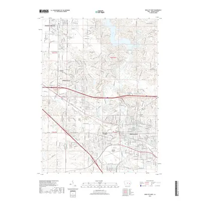
2018 Map of Iowa City West
USGS Topo · Published 2018About this map
The Iowa River cuts a winding course through this Johnson County landscape, separating the dense urban grid of Iowa City from its western suburbs and institutional centers. This 2018 survey documents the mature expansion of the region, where the Crandic RR corridor and major roadways like Melrose Ave connect established neighborhoods to newer developments such as University Heights and Coralville. The density of the built environment is balanced by extensive greenbelts along the Clear Creek Greenway and the southern reaches of Muddy Creek.
Find a feature on this map
163 named features on this map. Tap any name to fly to it.
Don’t see what you’re looking for? This feature index may not catch every label — zoom into the map to look around manually.
Map Details
Editions of this 2018 Iowa City West Map
This is the sole edition of this map. No revisions or reprints were ever made.
Other maps of this area

1887 · Cedar Rapids
USGS Topo · 1:62,500

1891 · Mechanicsville
USGS Topo · 1:62,500

1891 · Cedar Rapids
USGS Topo · 1:62,500

1891 · Iowa City
USGS Topo · 1:62,500

1894 · Mechanicsville
USGS Topo · 1:62,500

1894 · West Liberty
USGS Topo · 1:62,500

1901 · Stanwood
USGS Topo · 1:125,000

1903 · Fairfax
USGS Topo · 1:125,000

1938 · Iowa City
USGS Topo · 1:62,500

1958 · Davenport
USGS Topo · 1:250,000