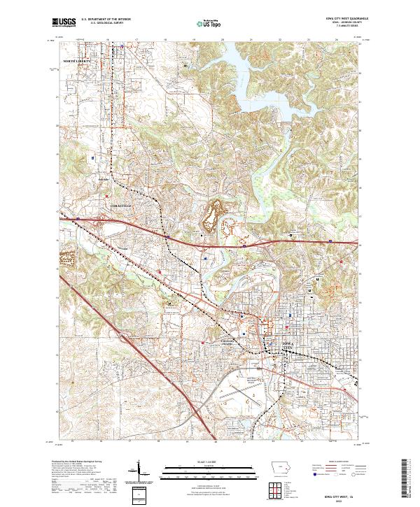
2022 Map of Iowa City West
USGS Topo · Published 2022About this map
Iowa City and its western suburbs appear here during a period of significant collegiate and commercial expansion. The urban core is anchored by the University of Iowa and the Johnson County Courthouse, while the landscape to the west shows the sprawling development of Coralville and University Heights. The Iowa River serves as the central geographic spine, flanked by the Iowa River Corridor Trl and a network of recreation paths like the Clear Creek Trail.
Find a feature on this map
181 named features on this map. Tap any name to fly to it.
Don’t see what you’re looking for? This feature index may not catch every label — zoom into the map to look around manually.
Map Details
Editions of this 2022 Iowa City West Map
This is the sole edition of this map. No revisions or reprints were ever made.
Other maps of this area

1887 · Cedar Rapids
USGS Topo · 1:62,500

1891 · Mechanicsville
USGS Topo · 1:62,500

1891 · Cedar Rapids
USGS Topo · 1:62,500

1891 · Iowa City
USGS Topo · 1:62,500

1894 · Mechanicsville
USGS Topo · 1:62,500

1894 · West Liberty
USGS Topo · 1:62,500

1901 · Stanwood
USGS Topo · 1:125,000

1903 · Fairfax
USGS Topo · 1:125,000

1938 · Iowa City
USGS Topo · 1:62,500

1958 · Davenport
USGS Topo · 1:250,000