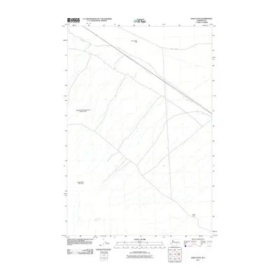
2011 Map of Iowa Flats
USGS Topo · Published 2011About this map
Rattlesnake Mountain dominates the western skyline of this central Washington landscape, standing as a prominent landmark above the namesake Iowa Flats. The terrain is characterized by the expansive Rattlesnake Hills Research Natural Area, a preserved space that reflects the arid ecology of the region. Water remains a critical element for the area's history, represented by the presence of Sam White Spring and the drainage of Cold Creek, which cuts through the northern portion of the quadrangle. Transportation is defined by the utilitarian Army Loop Rd and State Route 24, providing access to the higher elevations of Goose Egg Hill. The sparse settlement and specialized land use patterns underscore the region's role in research and resource management during the early 21st century.
Find a feature on this map
7 named features on this map. Tap any name to fly to it.
Don’t see what you’re looking for? This feature index may not catch every label — zoom into the map to look around manually.
Map Details
Editions of this 2011 Iowa Flats Map
This is the sole edition of this map. No revisions or reprints were ever made.
Other maps of this area

1915 · Prosser
USGS Topo · 1:125,000

1916 · Coyote Rapids
USGS Topo · 1:62,500

1917 · Pasco
USGS Topo · 1:125,000

1917 · Prosser
USGS Topo · 1:125,000

1924 · Hanford
USGS Topo · 1:62,500

1951 · Richland
USGS Topo · 1:62,500

1951 · Hanford
USGS Topo · 1:62,500

1951 · Corral Canyon
USGS Topo · 1:62,500

1951 · Coyote Rapids
USGS Topo · 1:62,500

1953 · Walla Walla
USGS Topo · 1:250,000