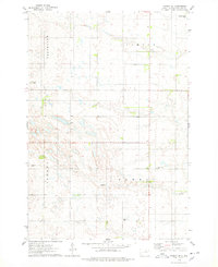
1974 Map of Ipswich SE
USGS Topo · Published 1978About this map
Liberty, Powell, Harmony, and Cleveland townships partition this stretch of the South Dakota prairie during the mid-1970s. The landscape is defined by the section-line roads of the Public Land Survey System, which connect small rural hubs and family landmarks. The settlement at Powell and the nearby Pleasant Hill Cem serve as focal points for local history and genealogy, situated near the elevation of Pleasant Hill. Resource extraction and water management are evident through scattered Gravel Pits and several instances of a Flowing Well that puncture the terrain. The inclusion of named locations like Chester, John, and Oliver provides a specific record of local nomenclature and land use in Edmunds County before late-century consolidation altered the rural fabric.
Find a feature on this map
14 named features on this map. Tap any name to fly to it.
Don’t see what you’re looking for? This feature index may not catch every label — zoom into the map to look around manually.
Map Details
Editions of this 1974 Ipswich SE Map
This is the sole edition of this map. No revisions or reprints were ever made.
Other maps of this area

1899 · Northville
USGS Topo · 1:125,000

1952 · Norbeck
USGS Topo · 1:24,000

1952 · Wecota
USGS Topo · 1:24,000

1954 · Aberdeen
USGS Topo · 1:250,000

1956 · Aberdeen
USGS Topo · 1:250,000

1966 · Cresbard
USGS Topo · 1:24,000

1970 · Mina SW
USGS Topo · 1:24,000

1970 · Mina NW
USGS Topo · 1:24,000
1978 · Stafford Dam
USGS Topo · 1:24,000

1978 · Beebe
USGS Topo · 1:24,000