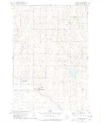
1978 Map of Stafford Dam
USGS Topo · Published 1978About this map
Stafford Dam anchors this landscape in Edmunds County, serving as a focal point for water management and recreation in the late 1970s. The area is defined by a series of distinct townships, including Montpelier, Cleveland, Vermont, and Liberty, which organize the rural grid. This territory is heavily dedicated to conservation and public land use, notably through the National Waterfowl Production Area and the Stafford Dam State Public Shooting Area, reflecting the region's importance for migratory birds and local hunters. Infrastructure for leisure and aviation is also evident, with a Boat Ramp near the dam and a Landing Field to the northeast. Small-scale resource extraction is indicated by scattered Gravel Pits, while local heritage is preserved at St Johns Cem. A Flowing Well in the central portion of the sheet highlights the groundwater characteristics of the prairie.
Find a feature on this map
13 named features on this map. Tap any name to fly to it.
Don’t see what you’re looking for? This feature index may not catch every label — zoom into the map to look around manually.
Map Details
Editions of this 1978 Stafford Dam Map
This is the sole edition of this map. No revisions or reprints were ever made.
Other maps of this area

1951 · Clark Lake
USGS Topo · 1:24,000

1952 · Norbeck
USGS Topo · 1:24,000

1952 · Wecota
USGS Topo · 1:24,000

1954 · Aberdeen
USGS Topo · 1:250,000

1956 · Aberdeen
USGS Topo · 1:250,000
1974 · Ipswich SE
USGS Topo · 1:24,000

1974 · Roscoe
USGS Topo · 1:24,000

1978 · Loyalton
USGS Topo · 1:24,000

1978 · Beebe
USGS Topo · 1:24,000
1978 · Ipswich
USGS Topo · 1:24,000