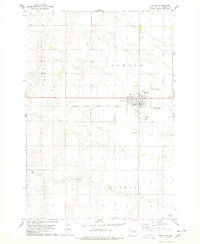
1978 Map of Ipswich
USGS Topo · Published 1978About this map
The town of Ipswich serves as the focal point of this prairie landscape, centered at the intersection of local routes and the Chicago Milwaukee ST Paul And Pacific railroad. In the late 1970s, the community layout included essential civic features like the Hospital and Sewage Disposal plant, alongside leisure and transport hubs like the Golf Course and the Bloemendaal-Taylor Airfield. The surrounding townships of Huntley, Ipswich, Cleveland, and Harmony reveal a highly organized agricultural grid defined by property fences and field lines.
Find a feature on this map
21 named features on this map. Tap any name to fly to it.
Don’t see what you’re looking for? This feature index may not catch every label — zoom into the map to look around manually.
Map Details
Editions of this 1978 Ipswich Map
This is the sole edition of this map. No revisions or reprints were ever made.
Other maps of this area

1899 · Ellendale
USGS Topo · 1:125,000

1899 · Northville
USGS Topo · 1:125,000

1954 · Aberdeen
USGS Topo · 1:250,000

1956 · Aberdeen
USGS Topo · 1:250,000

1970 · Mina SW
USGS Topo · 1:24,000

1970 · Mina NW
USGS Topo · 1:24,000

1970 · Leola SW
USGS Topo · 1:24,000
1974 · Ipswich SE
USGS Topo · 1:24,000
1978 · Stafford Dam
USGS Topo · 1:24,000

1978 · Beebe
USGS Topo · 1:24,000