
1974 Map of Roscoe
USGS Topo · Published 1978About this map
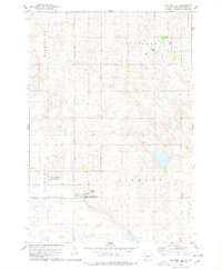
Roscoe serves as the central hub of this 1974 survey, defined by its position at the intersection of significant rail lines and regional boundaries. The Chicago Milwaukee St Paul and Pacific railroad cuts directly through the settlement, alongside the C M St P & P line, highlighting the town's importance as a transportation node in Edmunds County. The surrounding landscape is a mix of agricultural utility and conservation, with several Gravel Pits dotting the northern sections while the National Waterfowl Production Area occupies the central wetlands to the south. Local landmarks like the Golf Course and Morningside Cem provide clear points of reference for genealogists and local historians tracking the mid-century footprint of this South Dakota community. The map also delineates the townships of Glencoe, Bryant, and Montpelier.
Find a feature on this map
12 named features on this map. Tap any name to fly to it.
Don’t see what you’re looking for? This feature index may not catch every label — zoom into the map to look around manually.
Map Details
Editions of this 1974 Roscoe Map
This is the sole edition of this map. No revisions or reprints were ever made.
Other maps of this area

1954 · Aberdeen
USGS Topo · 1:250,000

1956 · Aberdeen
USGS Topo · 1:250,000

1974 · Roscoe SW
USGS Topo · 1:24,000

1978 · Loyalton
USGS Topo · 1:24,000
1978 · Stafford Dam
USGS Topo · 1:24,000

1978 · Beebe
USGS Topo · 1:24,000

1978 · Roscoe NW
USGS Topo · 1:24,000

1978 · Hosmer SE
USGS Topo · 1:24,000

1978 · Hosmer
USGS Topo · 1:24,000
1978 · Plainview Colony SW
USGS Topo · 1:24,000