
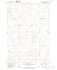
1978 Map of Hosmer SE
USGS Topo · Published 1979About this map
Glacial potholes and small water bodies dominate this prairie landscape along the county line between McPherson County and Edmunds County. During the late 1970s, this area of South Dakota was defined by its geometric township divisions and small-scale gravel extraction. The map preserves the location of rural landmarks essential for genealogical research, including Mohr Cem in the north and Hope Cem to the southwest. Civil townships like Sangamon, North Bryant, Bryant, and Gleno provide a clear framework for identifying historic land tracts and homesteads. Scattered Gravel Pit operations and various wells indicate the localized nature of the rural economy, while numerous benchmark elevations such as BM 1879 document the subtle topography of the Great Plains before modern agricultural consolidation significantly altered the landscape's finer details.
Find a feature on this map
12 named features on this map. Tap any name to fly to it.
Don’t see what you’re looking for? This feature index may not catch every label — zoom into the map to look around manually.
Map Details
Editions of this 1978 Hosmer SE Map
This is the sole edition of this map. No revisions or reprints were ever made.
Other maps of this area

1954 · Aberdeen
USGS Topo · 1:250,000

1956 · Aberdeen
USGS Topo · 1:250,000

1974 · Roscoe
USGS Topo · 1:24,000

1978 · Beebe
USGS Topo · 1:24,000

1978 · Roscoe NW
USGS Topo · 1:24,000

1978 · Hosmer NW
USGS Topo · 1:24,000

1978 · Hosmer NE
USGS Topo · 1:24,000

1978 · Hosmer
USGS Topo · 1:24,000

1978 · Plainview Colony NW
USGS Topo · 1:24,000
1978 · Plainview Colony SW
USGS Topo · 1:24,000