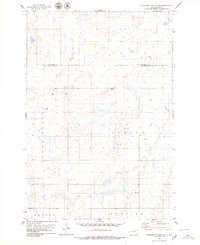
1978 Map of Plainview Colony SW
USGS Topo · Published 1979About this map
The borderlands of Mc Pherson Co and Edmunds Co characterize this prairie landscape as it appeared in the late 1970s. The area is defined by its townships, including North Bryant, Adrian, and Huntley, reflecting the rural administrative structure typical of the region. This is a landscape shaped by glacial activity, dotted with numerous small lakes and wetlands that punctuate the agricultural sections. Human industry is represented primarily by small-scale resource extraction, with several Gravel Pits and isolated Gravel Pits scattered across the map, often located near the winding sections of local roads. The survey also notes fine red dashed lines indicating selected fence and field lines, offering a precise look at late-twentieth-century land management and ownership patterns in this part of South Dakota.
Find a feature on this map
6 named features on this map. Tap any name to fly to it.
Don’t see what you’re looking for? This feature index may not catch every label — zoom into the map to look around manually.
Map Details
Editions of this 1978 Plainview Colony SW Map
This is the sole edition of this map. No revisions or reprints were ever made.
Other maps of this area

1954 · Aberdeen
USGS Topo · 1:250,000

1956 · Aberdeen
USGS Topo · 1:250,000

1974 · Roscoe
USGS Topo · 1:24,000

1978 · Beebe
USGS Topo · 1:24,000
1978 · Ipswich
USGS Topo · 1:24,000

1978 · Hosmer NE
USGS Topo · 1:24,000

1978 · Hosmer SE
USGS Topo · 1:24,000
1978 · Plainview Colony
USGS Topo · 1:24,000
1978 · Plainview Colony NE
USGS Topo · 1:24,000

1978 · Plainview Colony NW
USGS Topo · 1:24,000