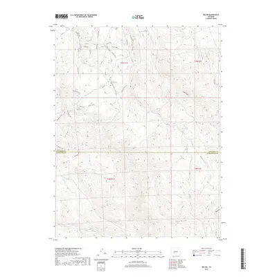
2019 Map of Iris NW
USGS Topo · Published 2019About this map
The high-elevation boundary between Gunnison and Saguache counties is defined by a landscape of intricate drainages and ridgelines. Waterways such as S Beaver Cr and Pole Cr carve through the terrain, while landmarks like Rocky Ridge and the Sea of Sage suggest the character of the vegetation and geology in this part of the Colorado interior. The map reveals a dense network of modern recreational and access routes, including The Luge Trail, Broken Shovel, and the Enchanted Forest.
Find a feature on this map
49 named features on this map. Tap any name to fly to it.
Don’t see what you’re looking for? This feature index may not catch every label — zoom into the map to look around manually.
Map Details
Editions of this 2019 Iris NW Map
This is the sole edition of this map. No revisions or reprints were ever made.
Other maps of this area
1908 · Uncompahgre
USGS Topo · 1:125,000
1911 · Uncompahgre
USGS Topo · 1:125,000
1954 · Iris NW
USGS Topo · 1:24,000
1954 · Iola
USGS Topo · 1:24,000
1954 · Mc Intosh Mountain
USGS Topo · 1:24,000
1954 · Gunnison
USGS Topo · 1:24,000

1956 · Montrose
USGS Topo · 1:250,000
1959 · Montrose
USGS Topo · 1:250,000
1960 · Montrose
USGS Topo · 1:250,000
1962 · Iris
USGS Topo · 1:24,000