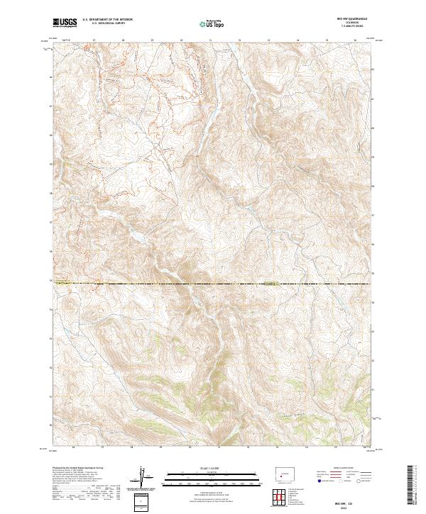
2022 Map of Iris NW
USGS Topo · Published 2022About this map
The high-country terrain along the Gunnison Co Saguache Co border is defined by a dense network of trails and seasonal drainages as recorded in 2022. The landscape is characterized by prominent gulches including Stubbs Gulch, Long Gulch, and Chance Gulch, which feed into local waterways such as Gold Basin Cr and Sugar Cr. This area serves as a significant recreational and ranching corridor, evidenced by the proliferation of named trails like the Skyline Trl, Broken Shovel Trl, and Skull Pass Trl. The map illustrates how human activity, primarily through trail systems like the Enchanted Forest Trl and Rocky Ridge Trl, has integrated with the natural drainage patterns of the Southern Rocky Mountains. Local infrastructure is supported by Co RD 32 and Co RD 40, providing access across this transition from Gunnison into Saguache County.
Find a feature on this map
44 named features on this map. Tap any name to fly to it.
Don’t see what you’re looking for? This feature index may not catch every label — zoom into the map to look around manually.
Map Details
Editions of this 2022 Iris NW Map
This is the sole edition of this map. No revisions or reprints were ever made.
Other maps of this area

1908 · Uncompahgre
USGS Topo · 1:125,000

1911 · Uncompahgre
USGS Topo · 1:125,000

1954 · Iris NW
USGS Topo · 1:24,000

1954 · Iola
USGS Topo · 1:24,000

1954 · Mc Intosh Mountain
USGS Topo · 1:24,000

1954 · Gunnison
USGS Topo · 1:24,000

1956 · Montrose
USGS Topo · 1:250,000

1959 · Montrose
USGS Topo · 1:250,000

1960 · Montrose
USGS Topo · 1:250,000

1962 · Iris
USGS Topo · 1:24,000