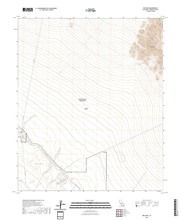
2021 Map of Iris Wash
USGS Topo · Published 2021About this map
Imperial Valley and East Mesa define the landscape of this Imperial County desert terrain, where the arid environment is intersected by critical water infrastructure. The Coachella Canal and Coachella Canal Rd cut a diagonal path across the southwest, representing the vital irrigation systems that sustain life in the region. To the northeast, the topography rises sharply into the Chocolate Mountains, providing a stark contrast to the low-lying valley floor.
Find a feature on this map
17 named features on this map. Tap any name to fly to it.
Don’t see what you’re looking for? This feature index may not catch every label — zoom into the map to look around manually.
Map Details
Editions of this 2021 Iris Wash Map
This is the sole edition of this map. No revisions or reprints were ever made.
Other maps of this area

1940 · Iris
USGS Topo · 1:62,500

1940 · Frink
USGS Topo · 1:62,500

1940 · Iris Pass
USGS Topo · 1:62,500

1944 · Calipatria
USGS Topo · 1:62,500

1944 · Frink
USGS Topo · 1:62,500

1945 · Iris Pass
USGS Topo · 1:62,500

1945 · Iris
USGS Topo · 1:62,500

1954 · Salton Sea
USGS Topo · 1:250,000

1955 · Tortuga
USGS Topo · 1:24,000

1955 · Salton Sea
USGS Topo · 1:250,000