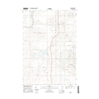
2015 Map of Irma
USGS Topo · Published 2015About this map
The Wisconsin River snakes through the northwestern corner of this Lincoln County landscape, feeding into the Grandmother Flowage. The settlement of Irma serves as a central hub, situated near the intersection of several county roads and the elevation of Irma Hill. To the south, the community of Otis sits along the primary highway corridor, reflecting the dispersed rural settlement pattern of northern Wisconsin.
Find a feature on this map
64 named features on this map. Tap any name to fly to it.
Don’t see what you’re looking for? This feature index may not catch every label — zoom into the map to look around manually.
Map Details
Editions of this 2015 Irma Map
This is the sole edition of this map. No revisions or reprints were ever made.
Other maps of this area

1899 · Wausau
USGS Topo · 1:125,000

1902 · Wausau
USGS Topo · 1:125,000

1902 · Marathon
USGS Topo · 1:125,000

1950 · Tomahawk
USGS Topo · 1:48,000

1950 · Spirit Falls
USGS Topo · 1:48,000

1951 · Merrill
USGS Topo · 1:48,000

1951 · Hamburg
USGS Topo · 1:48,000

1952 · Spirit Falls
USGS Topo · 1:48,000

1952 · Tomahawk
USGS Topo · 1:48,000

1954 · Iron Mountain
USGS Topo · 1:250,000