2022 Map of Iron Belt
USGS Topo · Published 2022About this map
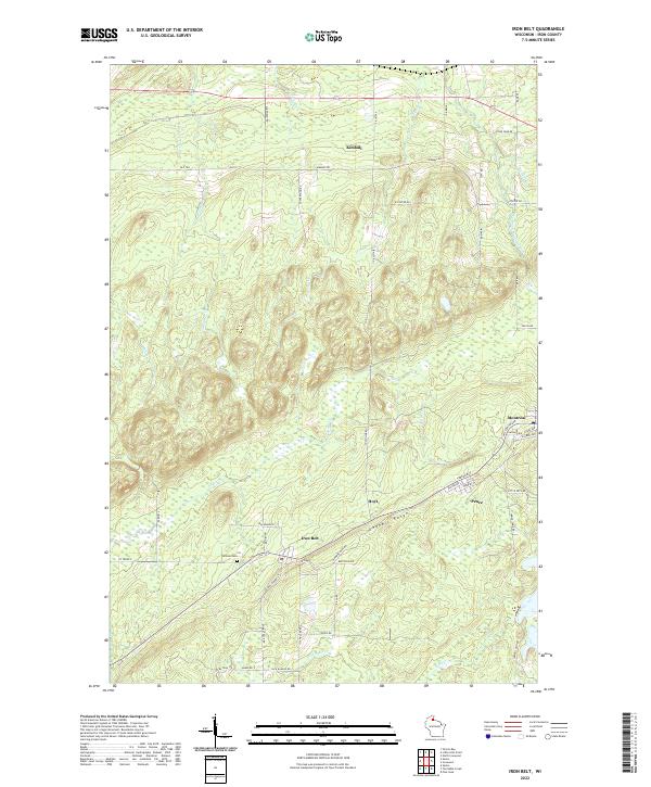
The Gogebic Range dominates the southern landscape of this Wisconsin iron district, where the industrial legacy of the Penokee-Gogebic ore deposits is written into the modern road network. The settlement of Iron Belt serves as a central hub, situated near Hillside Cem and the remnants of mining operations suggested by Plummer Mine Rd. This area reflects the tight-knit grid of company-era towns like Montreal and Pence, where residential streets such as Indiana Ave and Texas Ave cluster against the rising topography of the range. To the north, the terrain transitions into a complex drainage system defined by the West Fork Montreal River and numerous tributaries including Flood Cr and Boomer Cr, illustrating the relationship between the elevated mineral ridges and the lowland wetlands of the Potato River basin.
Find a feature on this map
58 named features on this map. Tap any name to fly to it.
Don’t see what you’re looking for? This feature index may not catch every label — zoom into the map to look around manually.
Map Details
Editions of this 2022 Iron Belt Map
This is the sole edition of this map. No revisions or reprints were ever made.