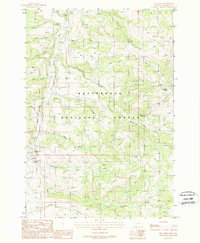
1988 Map of Iron Creek
USGS Topo · Published 1988About this map
Beaverhead National Forest land dominates this high-elevation terrain in Madison County, defined by a dense network of mountain streams and drainage basins. The Ruby River flows through the western portion of the sheet, fed by numerous named tributaries including Bull Creek, Jug Creek, and Poison Creek. This landscape is characterized by its vital water sources, as evidenced by several named springs such as Dog Creek Spring, Cow Camp Spring, and Bear Creek Spring. Traces of human activity are concentrated around water and grazing resources, most notably at the Three Forks Cow Camp. The eastern topography rises into the Maverick Basin, anchored by the prominent Strawberry Butte. A lone Campground near the river suggests the area's use for recreation and seasonal land management during the late twentieth century.
Find a feature on this map
31 named features on this map. Tap any name to fly to it.
Don’t see what you’re looking for? This feature index may not catch every label — zoom into the map to look around manually.
Map Details
Editions of this 1988 Iron Creek Map
This is the sole edition of this map. No revisions or reprints were ever made.
Other maps of this area

1888 · Three Forks
USGS Topo · 1:250,000

1893 · Dillon
USGS Topo · 1:250,000

1894 · Three Forks
USGS Topo · 1:250,000

1895 · Three Forks
USGS Topo · 1:250,000

1947 · Bozeman
USGS Topo · 1:250,000

1948 · Bozeman
USGS Topo · 1:250,000

1949 · Varney
USGS Topo · 1:62,500

1950 · Monument Ridge
USGS Topo · 1:62,500

1955 · Bozeman
USGS Topo · 1:250,000

1955 · Dubois
USGS Topo · 1:250,000