
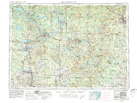
1954 Map of Iron Mountain
USGS Topo · Published 1964About this map
Iron Mountain and the neighboring industrial centers of Kingsford and Niagara anchor the northeastern corner of this mid-century survey, where the Menominee River serves as the dividing line between Michigan and Wisconsin. The landscape is defined by its deep timber and mineral heritage, with the Iron Range and various fire towers scattered across the Nicolet National Forest and Chequamegon National Forest.
Find a feature on this map
135 named features on this map. Tap any name to fly to it.
Don’t see what you’re looking for? This feature index may not catch every label — zoom into the map to look around manually.
Map Details
Editions of this 1954 Iron Mountain Map
2 editions found
Other maps of this area

1898 · Iron River
USGS Topo · 1:62,500

1899 · Sagola
USGS Topo · 1:62,500

1899 · Crystal Falls
USGS Topo · 1:62,500

1899 · Wausau
USGS Topo · 1:125,000

1902 · Wausau
USGS Topo · 1:125,000

1902 · Marathon
USGS Topo · 1:125,000

1928 · Three Lakes
USGS Topo · 1:48,000

1930 · Robbins
USGS Topo · 1:48,000

1938 · Phelps
USGS Topo · 1:48,000

1938 · Minocqua
USGS Topo · 1:48,000