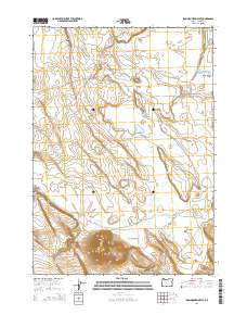
2014 Map of Iron Mountain Flat
USGS Topo · Published 2014About this map
Iron Mountain rises as the dominant landmark of this high desert landscape, overlooking the expansive Iron Mountain Flat in eastern Oregon. The terrain is defined by isolated water sources essential for cattle and wildlife, including Lakebed Waterhole, Deadbull Waterhole, and numerous springs such as Crane Spring and Willow Spring. These scattered points suggest the area's ongoing importance for ranching and resource management in a semi-arid environment.
Find a feature on this map
24 named features on this map. Tap any name to fly to it.
Don’t see what you’re looking for? This feature index may not catch every label — zoom into the map to look around manually.
Map Details
Editions of this 2014 Iron Mountain Flat Map
This is the sole edition of this map. No revisions or reprints were ever made.
Other maps of this area

1955 · Burns
USGS Topo · 1:250,000

1958 · Burns
USGS Topo · 1:250,000

1959 · Burns
USGS Topo · 1:250,000
1979 · Moon Reservoir
USGS Topo · 1:24,000
1980 · Capehart Lake
USGS Topo · 1:24,000
1980 · Hughet Spring
USGS Topo · 1:24,000
1980 · Lunch Lake
USGS Topo · 1:24,000
1980 · Iron Mtn. Flat
USGS Topo · 1:24,000
1980 · Stinking Lake
USGS Topo · 1:24,000
1980 · Lake on The Trail
USGS Topo · 1:24,000