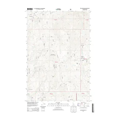
2013 Map of Iron Mountain
USGS Topo · Published 2013About this map
Nez Perce National Forest dominates this high-country landscape in Idaho County, where rugged ridge systems and deep drainage basins define the geography. The terrain is structured by prominent features such as Radcliff Ridge in the northwest and Ericson Ridge to the east, with Iron Mtn serving as a central high point. Waterways including Big Elk Cr, W Fork O'Hara Cr, and Little Elk Cr carve through the wilderness, converging near locations like The Narrows. This survey shows a remote area primarily utilized for recreation and resource management, documented through the presence of the Table Meadows Campground, Red Horse Campground, and Sing Lee Campground. A network of Forest Service routes, including O Hara Creek Rd and Iron Mountain Rd, provides the only access through this steep timberland, connecting isolated points like Nugget Point and Elk Summit.
Find a feature on this map
44 named features on this map. Tap any name to fly to it.
Don’t see what you’re looking for? This feature index may not catch every label — zoom into the map to look around manually.
Map Details
Editions of this 2013 Iron Mountain Map
This is the sole edition of this map. No revisions or reprints were ever made.
Other maps of this area

1911 · Lolo
USGS Topo · 1:250,000

1913 · Lolo
USGS Topo · 1:250,000

1924 · Weippe
USGS Topo · 1:125,000

1931 · Buffalo Hump
USGS Topo · 1:125,000

1934 · Buffalo Hump
USGS Topo · 1:125,000

1956 · Elk City
USGS Topo · 1:250,000

1956 · Hamilton
USGS Topo · 1:250,000

1959 · Hamilton
USGS Topo · 1:250,000

1960 · Elk City
USGS Topo · 1:250,000

1960 · Hamilton
USGS Topo · 1:250,000