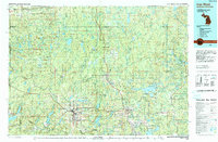
1989 Map of Iron River
USGS Topo · Published 1990About this map
The dense forests and iron-rich landscapes of the Upper Peninsula define this late-century survey, centered on the historic mining and timber corridor of the western Iron Range. Industrial footprints remain visible at sites like the Monongahela Mine, while the cluster of settlements including Mineral Hills, Caspian, and Stambaugh shows the concentrated development near the Wisconsin border. Beyond the town centers, the land is dominated by the Ottawa National Forest and Copper Country State Forest, where an extensive network of lakes such as Perch Lake and Net River provided the necessary resources for early logging operations.
Find a feature on this map
116 named features on this map. Tap any name to fly to it.
Don’t see what you’re looking for? This feature index may not catch every label — zoom into the map to look around manually.
Map Details
Editions of this 1989 Iron River Map
This is the sole edition of this map. No revisions or reprints were ever made.
Other maps of this area

1895 · Ned Lake
USGS Topo · 1:62,500

1895 · Perch Lake
USGS Topo · 1:62,500

1898 · Iron River
USGS Topo · 1:62,500

1899 · Sagola
USGS Topo · 1:62,500

1899 · Witbeck
USGS Topo · 1:62,500

1899 · Crystal Falls
USGS Topo · 1:62,500

1928 · Three Lakes
USGS Topo · 1:48,000

1938 · Phelps
USGS Topo · 1:48,000

1938 · Alvin
USGS Topo · 1:48,000

1938 · Three Lakes
USGS Topo · 1:48,000