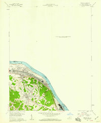
1958 Map of Ironton
USGS Topo · Published 1959About this map
The Ohio River corridor serves as the industrial and transportation backbone of this 1958 survey, where the heavy infrastructure of the Chesapeake and Ohio railroad tracks the southern bank. This era showcases a developing landscape of hilltop residential expansions like Russell Heights and Flatwoods rising above the river valley. The presence of the Ashland-Boyd County Airport and Our Lady of Bellefonte Hospital indicates the mid-century modernization of this tri-state border region.
Find a feature on this map
32 named features on this map. Tap any name to fly to it.
Don’t see what you’re looking for? This feature index may not catch every label — zoom into the map to look around manually.
Map Details
Editions of this 1958 Ironton Map
This is the sole edition of this map. No revisions or reprints were ever made.
Other maps of this area

1898 · Ironton
USGS Topo · 1:62,500

1900 · Ironton
USGS Topo · 1:62,500

1901 · Ceredo
USGS Topo · 1:62,500

1903 · Kenova
USGS Topo · 1:125,000

1904 · Kenova
USGS Topo · 1:125,000

1913 · Ceredo
USGS Topo · 1:62,500

1926 · Greenup
USGS Topo · 1:48,000

1930 · Greenup
USGS Topo · 1:62,500
1953 · Ashland
USGS Topo · 1:24,000

1953 · Greenup
USGS Topo · 1:24,000