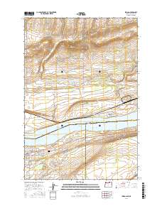
2017 Map of Irrigon
USGS Topo · Published 2017About this map
Irrigon stands on the southern bank of the Columbia River at a point where the river widens into Lake Umatilla, a landscape defined by the intersection of water and desert. This modern survey illustrates the town's street grid, featuring family-named routes like Rand Rd and Wilcox Ln that extend south toward the W Extension Irrigation Canal. The presence of the Desert Lawn Memorial Cem and the Po marker indicate the community's established civic core. Beyond the irrigated fields and residential blocks, the topography rises into the dry uplands of Morrow and Umatilla counties. Deep incisions such as Bing Canyon and Fourmile Canyon drain the northern heights toward the river, while the Irrigon Middle Range Channel marks a critical path for navigation within the Columbia's broad expanse.
Find a feature on this map
38 named features on this map. Tap any name to fly to it.
Don’t see what you’re looking for? This feature index may not catch every label — zoom into the map to look around manually.
Map Details
Editions of this 2017 Irrigon Map
This is the sole edition of this map. No revisions or reprints were ever made.
Other maps of this area
1906 · Blalock Island
USGS Topo · 1:125,000
1908 · Blalock Island
USGS Topo · 1:125,000
1908 · Umatilla
USGS Topo · 1:125,000
1915 · Prosser
USGS Topo · 1:125,000
1917 · Pasco
USGS Topo · 1:125,000
1917 · Prosser
USGS Topo · 1:125,000

1953 · Pendleton
USGS Topo · 1:250,000
1953 · Walla Walla
USGS Topo · 1:250,000

1956 · Pendleton
USGS Topo · 1:250,000
1958 · Walla Walla
USGS Topo · 1:250,000