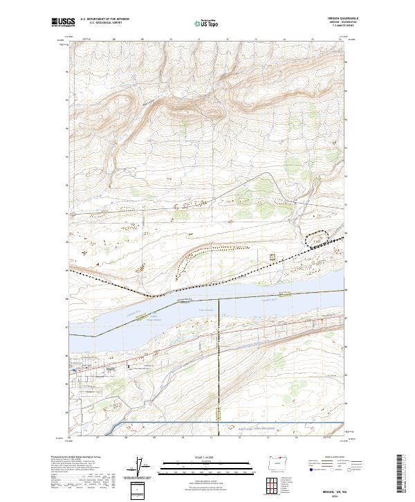
2024 Map of Irrigon
USGS Topo · Published 2024About this map
Irrigon stands as the primary settlement on this stretch of the Columbia River, where the high desert meets the modern engineered landscape of the Pacific Northwest. The town's grid is bounded by the West Extension Irrigation Canal, a vital water artery that enabled the region's agricultural development. To the north, the river expands into Lake Umatilla, a massive reservoir created by downstream dams, which now covers much of the historic shoreline. This survey captures the intersection of multiple jurisdictional boundaries, including the state line between Washington and Oregon and the convergence of Benton, Morrow, and Umatilla counties.
Find a feature on this map
35 named features on this map. Tap any name to fly to it.
Don’t see what you’re looking for? This feature index may not catch every label — zoom into the map to look around manually.
Map Details
Editions of this 2024 Irrigon Map
This is the sole edition of this map. No revisions or reprints were ever made.
Other maps of this area

1906 · Blalock Island
USGS Topo · 1:125,000

1908 · Blalock Island
USGS Topo · 1:125,000

1908 · Umatilla
USGS Topo · 1:125,000

1915 · Prosser
USGS Topo · 1:125,000

1917 · Pasco
USGS Topo · 1:125,000

1917 · Prosser
USGS Topo · 1:125,000

1953 · Pendleton
USGS Topo · 1:250,000

1953 · Walla Walla
USGS Topo · 1:250,000

1956 · Pendleton
USGS Topo · 1:250,000

1958 · Walla Walla
USGS Topo · 1:250,000