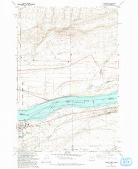
1993 Map of Irrigon
USGS Topo · Published 1993About this map
Irrigon serves as the hub of this Columbia River landscape, where the waters of Lake Umatilla separate the Oregon and Washington shorelines. The town's grid is established south of the river, containing essential local institutions such as Houghton Sch, Columbia Jr High Sch, and the Desert Lawn Memorial Cem. The industrial and agricultural character of the era is evident in the network of infrastructure, including the West Extension Canal and numerous Borrow Pits and gravel operations.
Find a feature on this map
30 named features on this map. Tap any name to fly to it.
Don’t see what you’re looking for? This feature index may not catch every label — zoom into the map to look around manually.
Map Details
Editions of this 1993 Irrigon Map
This is the sole edition of this map. No revisions or reprints were ever made.
Other maps of this area

1906 · Blalock Island
USGS Topo · 1:125,000

1908 · Blalock Island
USGS Topo · 1:125,000

1908 · Umatilla
USGS Topo · 1:125,000

1915 · Prosser
USGS Topo · 1:125,000

1917 · Pasco
USGS Topo · 1:125,000

1917 · Prosser
USGS Topo · 1:125,000

1953 · Pendleton
USGS Topo · 1:250,000

1953 · Walla Walla
USGS Topo · 1:250,000

1956 · Pendleton
USGS Topo · 1:250,000

1958 · Walla Walla
USGS Topo · 1:250,000