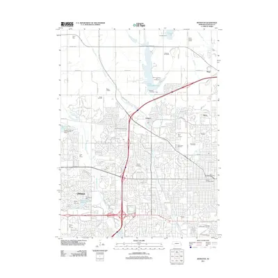
2011 Map of Irvington
USGS Topo · Published 2011About this map
Omaha's northwestern expansion is clearly visible in the transition from dense urban street grids to suburban developments and remaining open agricultural tracts like the Bryant Dairy Farm. This area is characterized by significant hydrological management, evidenced by the large Glenn Cunningham Lake and Standing Bear Reservoir, which serve as centers for recreation alongside the Glenn Cunningham Lake Campground. Historical and social institutions are well-represented, including the Saint James Orphanage and a cluster of regional burial grounds such as Mount Sinai Cemetery and Springwell Cemetery. Educational and commercial hubs are anchored by the University of Nebraska at Omaha and the Crossroads Station. The presence of smaller airstrips like Bates Airpark and Durands Sky Ranch reflects the localized aviation infrastructure serving the community during this era.
Find a feature on this map
64 named features on this map. Tap any name to fly to it.
Don’t see what you’re looking for? This feature index may not catch every label — zoom into the map to look around manually.
Map Details
Editions of this 2011 Irvington Map
This is the sole edition of this map. No revisions or reprints were ever made.
Other maps of this area

1893 · Omaha
USGS Topo · 1:62,500

1893 · Fremont
USGS Topo · 1:125,000

1896 · Fremont
USGS Topo · 1:125,000

1954 · Omaha
USGS Topo · 1:250,000

1955 · Fremont
USGS Topo · 1:250,000

1956 · Gretna
USGS Topo · 1:24,000

1956 · Ralston
USGS Topo · 1:24,000

1956 · Irvington
USGS Topo · 1:24,000

1956 · Omaha North
USGS Topo · 1:24,000

1956 · Omaha South
USGS Topo · 1:24,000