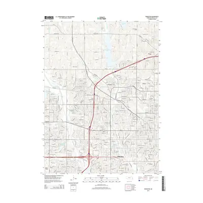
2014 Map of Irvington
USGS Topo · Published 2014About this map
Omaha's northwestern expansion is clearly visible in this modern topographic landscape, where established suburban developments meet the outlying historical communities of Irvington, Briggs, and Debolt. The northern reaches are dominated by significant water management and recreational features, most notably Glenn Cunningham Lake and the Standing Bear Reservoir, which control the flow of Little Papillion Cr and Big Papillion Cr. These reservoirs provide a sharp contrast to the dense residential grids of the city proper.
Find a feature on this map
44 named features on this map. Tap any name to fly to it.
Don’t see what you’re looking for? This feature index may not catch every label — zoom into the map to look around manually.
Map Details
Editions of this 2014 Irvington Map
This is the sole edition of this map. No revisions or reprints were ever made.
Other maps of this area

1893 · Omaha
USGS Topo · 1:62,500

1893 · Fremont
USGS Topo · 1:125,000

1896 · Fremont
USGS Topo · 1:125,000

1954 · Omaha
USGS Topo · 1:250,000

1955 · Fremont
USGS Topo · 1:250,000

1956 · Gretna
USGS Topo · 1:24,000

1956 · Ralston
USGS Topo · 1:24,000

1956 · Irvington
USGS Topo · 1:24,000

1956 · Omaha North
USGS Topo · 1:24,000

1956 · Omaha South
USGS Topo · 1:24,000