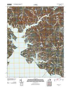
2010 Map of Irvington
USGS Topo · Published 2010About this map
Christ Church and the adjacent Christ Church Burying Ground anchor the central landscape of the Northern Neck in this 2010 study. The intricate coastline of the Corrotoman River and its branches, including the Western Branch Corrotoman River and Eastern Branch Corrotoman River, defines the region's geography. Historic water-based transportation remains evident through the Merry Point Ferry and various maritime landings like Ottoman Wharf and Yankee Point Landing.
Find a feature on this map
112 named features on this map. Tap any name to fly to it.
Don’t see what you’re looking for? This feature index may not catch every label — zoom into the map to look around manually.
Map Details
Editions of this 2010 Irvington Map
This is the sole edition of this map. No revisions or reprints were ever made.
Other maps of this area

1916 · Kilmarnock
USGS Topo · 1:48,000

1917 · Heathsville
USGS Topo · 1:48,000

1917 · Urbanna
USGS Topo · 1:62,500

1917 · Morattico
USGS Topo · 1:62,500

1917 · Kilmarnock
USGS Topo · 1:62,500

1918 · Morattico
USGS Topo · 1:62,500

1926 · Morattico
USGS Topo · 1:62,500

1942 · Kilmarnock
USGS Topo · 1:62,500

1943 · Richmond
USGS Topo · 1:250,000

1944 · Reedville
USGS Topo · 1:31,680