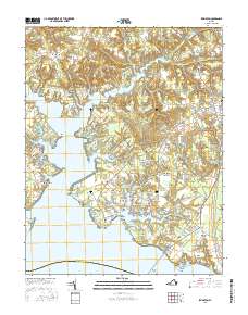
2016 Map of Irvington
USGS Topo · Published 2016About this map
Christ Church and its Christ Church Burying Ground anchor the central landscape of this Lancaster County coastal region, where the intricate fingers of the Corrotoman River meet the Chesapeake tide. The map reveals a densely patterned shoreline defined by numerous family-named points and coves, such as John Neck and Yopps Cove, reflecting generations of maritime settlement. In the east, the community of Kilmarnock serves as a local hub, while the village of Irvington sits near the mouth of Carter Cove. The presence of several established burial sites, including Old Saint Johns Cem and Mount Vernon Cem, offers significant detail for those tracing regional family history. Further north, the landscape transitions toward Iberis and Merry Point, where the Western Branch Corrotoman River begins its inland reach.
Find a feature on this map
189 named features on this map. Tap any name to fly to it.
Don’t see what you’re looking for? This feature index may not catch every label — zoom into the map to look around manually.
Map Details
Editions of this 2016 Irvington Map
This is the sole edition of this map. No revisions or reprints were ever made.
Other maps of this area

1916 · Kilmarnock
USGS Topo · 1:48,000

1917 · Heathsville
USGS Topo · 1:48,000

1917 · Urbanna
USGS Topo · 1:62,500

1917 · Morattico
USGS Topo · 1:62,500

1917 · Kilmarnock
USGS Topo · 1:62,500

1918 · Morattico
USGS Topo · 1:62,500

1926 · Morattico
USGS Topo · 1:62,500

1942 · Kilmarnock
USGS Topo · 1:62,500

1943 · Richmond
USGS Topo · 1:250,000

1944 · Reedville
USGS Topo · 1:31,680