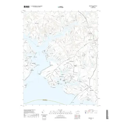
2019 Map of Irvington
USGS Topo · Published 2019About this map
Kilmarnock and the coastal settlements of the Northern Neck are defined by the intricate reaches of the Corrotoman River and Eastern Branch Carter Creek. This 2019 survey captures the modern landscape of Lancaster County, where historic landmarks like Christ Church and the adjacent Christ Church Burying Ground stand alongside newer educational hubs like Rappahannock Community College Kilmarnock Center. The geography is characterized by numerous points and necks, such as Yankee Point and Calf Pasture Point, reflecting a long history of maritime orientation. Local heritage is preserved in many small family and community burial sites, including Claybrook Cem and Mount Vernon Cem. The road network, anchored by Mary Ball Rd, connects established communities like White Stone, Irvington, and Weems, illustrating the transition from a water-dependent economy to a modern inland-connected coastal region.
Find a feature on this map
210 named features on this map. Tap any name to fly to it.
Don’t see what you’re looking for? This feature index may not catch every label — zoom into the map to look around manually.
Map Details
Editions of this 2019 Irvington Map
This is the sole edition of this map. No revisions or reprints were ever made.
Other maps of this area

1916 · Kilmarnock
USGS Topo · 1:48,000

1917 · Heathsville
USGS Topo · 1:48,000

1917 · Urbanna
USGS Topo · 1:62,500

1917 · Morattico
USGS Topo · 1:62,500

1917 · Kilmarnock
USGS Topo · 1:62,500

1918 · Morattico
USGS Topo · 1:62,500

1926 · Morattico
USGS Topo · 1:62,500

1942 · Kilmarnock
USGS Topo · 1:62,500

1943 · Richmond
USGS Topo · 1:250,000

1944 · Reedville
USGS Topo · 1:31,680