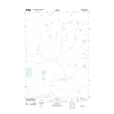
2011 Map of Irwin
USGS Topo · Published 2011About this map
The settlement of Irwin and its surrounding ranchlands define this corner of the High Plains near the Nebraska-South Dakota border. This landscape is characterized by a high density of alkali basins and small perennial water bodies, including Alkali Lake, North Twin Lake, and South Twin Lake. The presence of several named family operations, such as McGinley Ranch, Wiley Ranch, and Hathorn Ranch, underscores the area's long-standing reliance on cattle ranching and hay production. Significant water management efforts are visible in the long transit of the Horseshoe Drainage Ditch, which cuts across the central terrain. Low-lying hay ground is noted at Scott Meadow and Slim Meadow, while the local road network is centered on Irwin Rd, connecting the scattered ranch houses to the regional center.
Find a feature on this map
17 named features on this map. Tap any name to fly to it.
Don’t see what you’re looking for? This feature index may not catch every label — zoom into the map to look around manually.
Map Details
Editions of this 2011 Irwin Map
This is the sole edition of this map. No revisions or reprints were ever made.
Other maps of this area

1950 · Irwin
USGS Topo · 1:62,500

1951 · Irwin
USGS Topo · 1:62,500

1955 · Hot Springs
USGS Topo · 1:250,000

1955 · Alliance
USGS Topo · 1:250,000

1955 · Martin
USGS Topo · 1:250,000

1957 · Alliance
USGS Topo · 1:250,000

1957 · Valentine
USGS Topo · 1:250,000

1958 · Martin
USGS Topo · 1:250,000

1958 · Alliance
USGS Topo · 1:250,000

1959 · Valentine
USGS Topo · 1:250,000