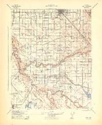
1942 Map of Irwin
USGS Topo · Published 1942About this map
The confluence of the San Joaquin River and Merced River anchors this 1940s landscape, illustrating a complex web of early Central Valley irrigation and transport. To the north, Turlock serves as a major hub on the Southern Pacific line, while the surrounding plains are crisscrossed by a sophisticated grid of water management features including the Ceres Canal, Stevinson Ditch, and High Line Canal.
Find a feature on this map
47 named features on this map. Tap any name to fly to it.
Don’t see what you’re looking for? This feature index may not catch every label — zoom into the map to look around manually.
Map Details
Editions of this 1942 Irwin Map
This is the sole edition of this map. No revisions or reprints were ever made.
Other maps of this area

1915 · Westport
USGS Topo · 1:31,680

1916 · Mitchell School
USGS Topo · 1:31,680

1916 · Crows Landing
USGS Topo · 1:31,680

1916 · Cressey
USGS Topo · 1:31,680

1916 · Montpellier
USGS Topo · 1:31,680

1916 · Denair
USGS Topo · 1:31,680

1916 · Ceres
USGS Topo · 1:31,680

1917 · Turlock
USGS Topo · 1:31,680

1917 · Newman
USGS Topo · 1:31,680

1918 · Arena
USGS Topo · 1:31,680