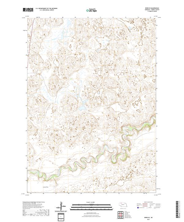
2021 Map of Irwin SE
USGS Topo · Published 2021About this map
The Niobrara River carves a deeply sinuous path through the southern half of this landscape, its tight oxbows and dramatic meanders defining the local topography. This portion of the Nebraska Sandhills shows a stark contrast between the river's riparian corridor and the expansive Lavaca Flats to the southwest. In the northern reaches, the drainage of Leander Creek feeds into Coffey Lake, illustrating the subtle hydrology of this prairie region. The map captures a largely open, rural territory where the natural water systems dictated the layout of early ranching and land use, preserved here in great detail by the U.S. Geological Survey.
Find a feature on this map
9 named features on this map. Tap any name to fly to it.
Don’t see what you’re looking for? This feature index may not catch every label — zoom into the map to look around manually.
Map Details
Editions of this 2021 Irwin SE Map
This is the sole edition of this map. No revisions or reprints were ever made.
Other maps of this area

1950 · Irwin
USGS Topo · 1:62,500

1951 · Irwin
USGS Topo · 1:62,500

1951 · Gypsy Valley
USGS Topo · 1:62,500

1951 · Merriman
USGS Topo · 1:62,500

1951 · Merriman 4
USGS Topo · 1:62,500

1957 · Valentine
USGS Topo · 1:250,000

1959 · Valentine
USGS Topo · 1:250,000

1985 · Cody
USGS Topo · 1:100,000
1990 · Merriman
USGS Topo · 1:24,000
1990 · Irwin
USGS Topo · 1:24,000