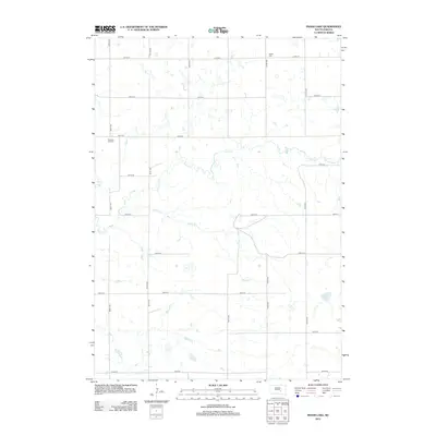
2012 Map of Isham Lake
USGS Topo · Published 2012About this map
The rolling plains of Jerauld County are defined by a network of intermittent drainage and rural section lines in this early 21st-century landscape. Isham Lake sits in the southeast corner, a focal point for the local hydrology alongside the meandering paths of Smith Cr and Sayles Cr. The area is marked by a rigid grid of gravel and dirt roads, including 366th Ave and 234th St, which trace the township and range boundaries established over a century prior.
Find a feature on this map
21 named features on this map. Tap any name to fly to it.
Don’t see what you’re looking for? This feature index may not catch every label — zoom into the map to look around manually.
Map Details
Editions of this 2012 Isham Lake Map
This is the sole edition of this map. No revisions or reprints were ever made.
Other maps of this area

1941 · Kimball North
USGS Topo · 1:62,500

1942 · Crow Lake
USGS Topo · 1:62,500

1951 · Kimball North
USGS Topo · 1:62,500

1953 · Huron
USGS Topo · 1:250,000

1954 · Huron
USGS Topo · 1:250,000

1955 · Mitchell
USGS Topo · 1:250,000

1959 · Mitchell
USGS Topo · 1:250,000

1973 · Gannvalley
USGS Topo · 1:24,000
1973 · Wessington Springs SW
USGS Topo · 1:24,000
1973 · Gannvalley SE
USGS Topo · 1:24,000