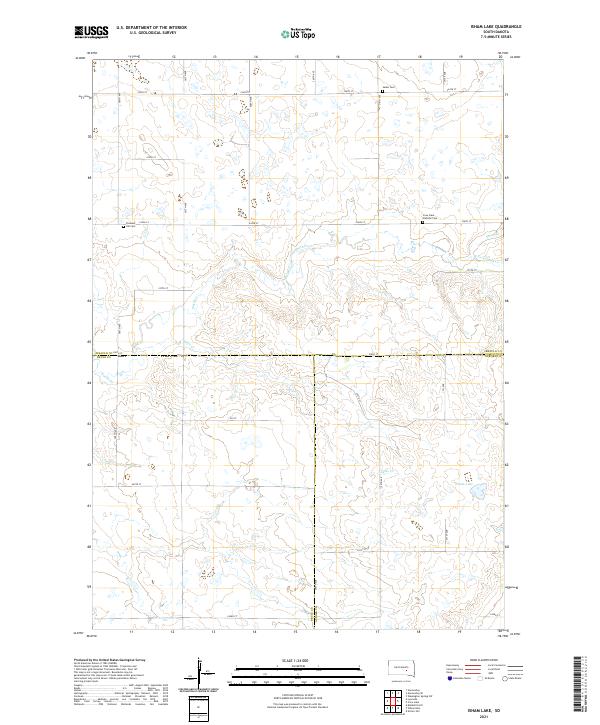
2021 Map of Isham Lake
USGS Topo · Published 2021About this map
The rolling plains at the intersection of Jerauld, Brule, and Aurora counties are defined by a network of seasonal drainages and local landmarks. Isham Lake sits in the southeastern quadrant, a focal point for the surrounding prairie. The landscape is primarily organized by a rigid grid of gravel roads, including 370th Ave and 238th St, which trace the section lines of the Public Land Survey System. These roads connect isolated burial grounds that reflect the area's rural heritage, such as Salem Cem in the north and the Crow Lake Catholic Cem further east.
Find a feature on this map
29 named features on this map. Tap any name to fly to it.
Don’t see what you’re looking for? This feature index may not catch every label — zoom into the map to look around manually.
Map Details
Editions of this 2021 Isham Lake Map
This is the sole edition of this map. No revisions or reprints were ever made.
Other maps of this area

1941 · Kimball North
USGS Topo · 1:62,500

1942 · Crow Lake
USGS Topo · 1:62,500

1951 · Kimball North
USGS Topo · 1:62,500

1953 · Huron
USGS Topo · 1:250,000

1954 · Huron
USGS Topo · 1:250,000

1955 · Mitchell
USGS Topo · 1:250,000

1959 · Mitchell
USGS Topo · 1:250,000

1973 · Gannvalley
USGS Topo · 1:24,000
1973 · Wessington Springs SW
USGS Topo · 1:24,000
1973 · Gannvalley SE
USGS Topo · 1:24,000