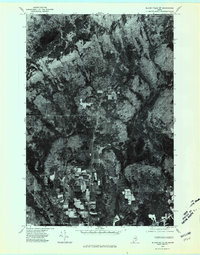
1975 Map of Island Falls SW
USGS Topo · Published 1980About this map
Patten anchors the southern edge of this orthophotoquad, which uses aerial imagery from 1975 to document the transition between worked agricultural lands and the thick forest of northern Penobscot County. The geography is defined by a series of waterways, including Long Brook and Adler Brook, which drain through the timbered hills toward Crystal Lake and its outlet at Crystal Brook. The photographic detail provides a clear view of the timber harvest patterns and field boundaries as they existed in the mid-1970s.
Find a feature on this map
8 named features on this map. Tap any name to fly to it.
Don’t see what you’re looking for? This feature index may not catch every label — zoom into the map to look around manually.
Map Details
Editions of this 1975 Island Falls SW Map
This is the sole edition of this map. No revisions or reprints were ever made.
Other maps of this area

1940 · Island Falls
USGS Topo · 1:62,500

1940 · Sherman
USGS Topo · 1:62,500

1942 · Island Falls
USGS Topo · 1:62,500

1942 · Sherman
USGS Topo · 1:62,500

1953 · Stacyville
USGS Topo · 1:62,500

1954 · Shin Pond
USGS Topo · 1:62,500

1954 · Presque Isle
USGS Topo · 1:250,000

1954 · Millinocket
USGS Topo · 1:250,000

1958 · Presque Isle
USGS Topo · 1:250,000

1958 · Millinocket
USGS Topo · 1:250,000