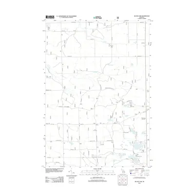
2012 Map of Island Lake
USGS Topo · Published 2012About this map
Union Corners and Shotgun Corners anchor this landscape of the Huron-Manistee National Forest region in the early twenty-first century. The area is defined by a dense cluster of glacial kettle lakes, including Island Lake, Loon Lake, and Wagner Lake, which support recreational sites like the Island Lake Recreation Area and Wagner Lake Campground. The E Br Big Cr and Lost Cr drain the northern sections of the map, carving through the terrain near the Sidewinder Golf Course. Local history and genealogy interests are centered at the Union Corners Cem located along Valley Rd. To the east, Timberline Mountain rises above the lake district, providing a prominent landmark near Shaw Lake and the Paul Bunyon Camp. A network of forest roads like Deyarmond Valley Rd and Mapes Rd connect these remote settlements and recreational outposts.
Find a feature on this map
64 named features on this map. Tap any name to fly to it.
Don’t see what you’re looking for? This feature index may not catch every label — zoom into the map to look around manually.
Map Details
Editions of this 2012 Island Lake Map
This is the sole edition of this map. No revisions or reprints were ever made.
Other maps of this area

1954 · Traverse City
USGS Topo · 1:250,000

1958 · Traverse City
USGS Topo · 1:250,000

1963 · Luzerne
USGS Topo · 1:24,000

1963 · Red Oak
USGS Topo · 1:24,000

1965 · Damon
USGS Topo · 1:24,000

1965 · St. Helen NE
USGS Topo · 1:24,000

1965 · Rose City
USGS Topo · 1:24,000

1972 · Mio
USGS Topo · 1:24,000

1972 · Mack Lake
USGS Topo · 1:24,000
1972 · Island Lake
USGS Topo · 1:24,000