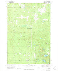
1972 Map of Island Lake
USGS Topo · Published 1975About this map
Huron National Forest and Foster State Forest dominate this wooded portion of Oscoda and Ogemaw counties. The landscape is defined by its glacial lake basins, including Loon Lake, Island Lake, and the uniquely named Muleshoe Lake. Scattered human activity is concentrated at intersections like Union Corners and Shotgun Corners, while the northern portion is crossed by a network of timber and access routes such as Coupland Road and Pierce Road.
Find a feature on this map
52 named features on this map. Tap any name to fly to it.
Don’t see what you’re looking for? This feature index may not catch every label — zoom into the map to look around manually.
Map Details
Editions of this 1972 Island Lake Map
2 editions found
Other maps of this area

1954 · Traverse City
USGS Topo · 1:250,000

1958 · Traverse City
USGS Topo · 1:250,000

1963 · Luzerne
USGS Topo · 1:24,000

1963 · Red Oak
USGS Topo · 1:24,000

1965 · Damon
USGS Topo · 1:24,000

1965 · St. Helen NE
USGS Topo · 1:24,000

1965 · Rose City
USGS Topo · 1:24,000

1972 · Mio
USGS Topo · 1:24,000

1972 · Mack Lake
USGS Topo · 1:24,000
1972 · Fairview
USGS Topo · 1:24,000