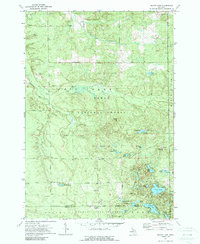
1972 Map of Island Lake
USGS Topo · Published 1989About this map
Huron National Forest and the Ogemaw State Forest dominate this landscape in north-central Michigan, where the boundary between Oscoda and Ogemaw counties meets. The terrain is defined by a glacial lake-and-knob topography, featuring a high concentration of water bodies including Loon Lake, Island Lake, and Crane Lake. In the southern portion of the sheet, an Old Railroad Grade cuts through the forest south of Stotts Lake, indicating the region's logging history and early transport network.
Find a feature on this map
50 named features on this map. Tap any name to fly to it.
Don’t see what you’re looking for? This feature index may not catch every label — zoom into the map to look around manually.
Map Details
Editions of this 1972 Island Lake Map
2 editions found
Other maps of this area

1954 · Traverse City
USGS Topo · 1:250,000

1958 · Traverse City
USGS Topo · 1:250,000

1963 · Luzerne
USGS Topo · 1:24,000

1963 · Red Oak
USGS Topo · 1:24,000

1965 · Damon
USGS Topo · 1:24,000

1965 · St. Helen NE
USGS Topo · 1:24,000

1965 · Rose City
USGS Topo · 1:24,000

1972 · Mio
USGS Topo · 1:24,000

1972 · Mack Lake
USGS Topo · 1:24,000
1972 · Island Lake
USGS Topo · 1:24,000