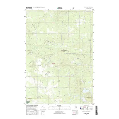
2017 Map of Island Lake
USGS Topo · Published 2017About this map
Huron National Forest covers the majority of this landscape, characterized by an intricate network of specialized recreational paths and glacial kettle lakes. The territory is a significant habitat for protected species, evidenced by the Kirtlands Warbler WMA in the south near the Oscoda and Ogemaw county line. For genealogists and local historians, the settlement at Union Corners serves as a primary landmark, featuring the Union Corners Cem and the nearby Hughes Grave tucked away off the Meadows - Hughes Lake Trail.
Find a feature on this map
54 named features on this map. Tap any name to fly to it.
Don’t see what you’re looking for? This feature index may not catch every label — zoom into the map to look around manually.
Map Details
Editions of this 2017 Island Lake Map
This is the sole edition of this map. No revisions or reprints were ever made.
Other maps of this area

1954 · Traverse City
USGS Topo · 1:250,000

1958 · Traverse City
USGS Topo · 1:250,000

1963 · Luzerne
USGS Topo · 1:24,000

1963 · Red Oak
USGS Topo · 1:24,000

1965 · Damon
USGS Topo · 1:24,000

1965 · St. Helen NE
USGS Topo · 1:24,000

1965 · Rose City
USGS Topo · 1:24,000

1972 · Mio
USGS Topo · 1:24,000

1972 · Mack Lake
USGS Topo · 1:24,000
1972 · Island Lake
USGS Topo · 1:24,000