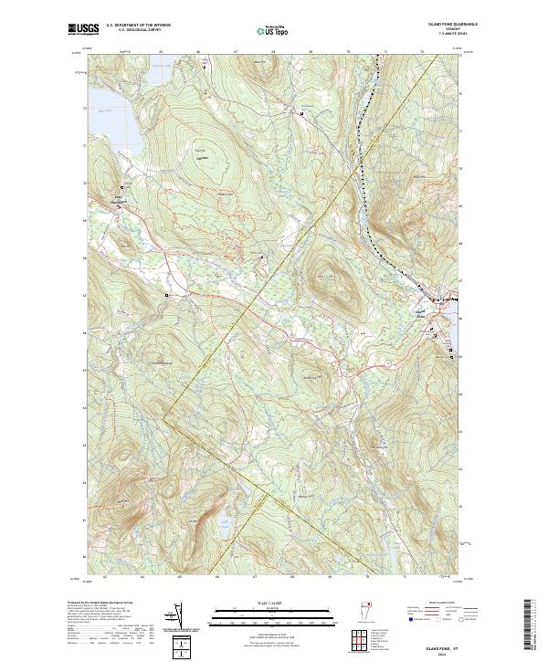
2024 Map of Island Pond
USGS Topo · Published 2024About this map
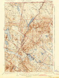
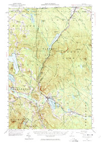
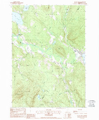
Island Pond serves as a primary hub in this Northeast Kingdom landscape, where the St Lawrence and Atlantic RR tracks navigate the narrow corridor between Bluff Mtn and the water. The settlement's history is preserved in a concentration of burial grounds, including the Old Protestant Cem, Old Catholic Cem, and New Catholic Cem, reflecting the diverse community that grew around the rail and timber industries. To the west, East Charleston sits along the Clyde River, which drains from the expansive Seymour Lake. The terrain is defined by significant elevations like Dolif Mtn and Job Mtn, with numerous smaller peaks such as Trip Hill and Rosebrook Hill shaping the drainage patterns of Mad Brook and Pherrins River. This network of brooks and ponds, including Jobs Pond and Sukes Pond, illustrates a classic glaciated upland environment where roads like Newark Rd follow the natural contours of the valleys.
Find a feature on this map
110 named features on this map. Tap any name to fly to it.
Don’t see what you’re looking for? This feature index may not catch every label — zoom into the map to look around manually.
Map Details
Editions of this 2024 Island Pond Map
This is the sole edition of this map. No revisions or reprints were ever made.
Historical Maps of Newark Through Time
5 maps found