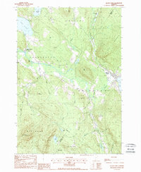
1988 Map of Island Pond
USGS Topo · Published 1988About this map
Island Pond and the surrounding townships of Brighton and Charleston define this landscape in the late 1980s. The village of Island Pond serves as a local hub, situated at the bend of the Clyde River and the lake from which it takes its name. The map documents the area's transition into a recreational and forest-management region, featuring the northern reaches of Willoughby State Forest and several large bodies of water including Seymour Lake and Echo Lake.
Find a feature on this map
54 named features on this map. Tap any name to fly to it.
Don’t see what you’re looking for? This feature index may not catch every label — zoom into the map to look around manually.
Map Details
Editions of this 1988 Island Pond Map
2 editions found
Other maps of this area

1919 · Lake Memphremagog
USGS Topo · 1:62,500

1920 · Derby
USGS Topo · 1:62,500

1923 · Lake Memphremagog
USGS Topo · 1:48,000

1924 · Island Pond
USGS Topo · 1:48,000

1925 · Memphremagog
USGS Topo · 1:62,500

1926 · Island Pond
USGS Topo · 1:62,500

1935 · Lyndonville
USGS Topo · 1:48,000

1939 · Lyndonville
USGS Topo · 1:62,500

1950 · Lake Champlain
USGS Topo · 1:250,000

1950 · Lewiston
USGS Topo · 1:250,000