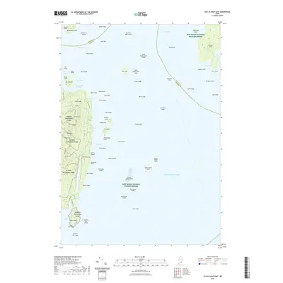
2021 Map of Isle Au Haut East
USGS Topo · Published 2021About this map
Isle Au Haut anchors this island-studded coastal survey, where the terrestrial wilderness of Acadia National Park meets the expansive waters of the Atlantic Ocean. The island's interior is defined by a series of prominent peaks, including Coombs Mtn, Mt Chaplain, and Rocky Mtn, providing a dramatic backdrop to the rugged eastern shoreline. The landscape is interconnected by a network of primitive routes such as the Horsemans Pt Trl and Long Pond Trl, reflecting the area's preservation for public recreation and conservation.
Find a feature on this map
89 named features on this map. Tap any name to fly to it.
Don’t see what you’re looking for? This feature index may not catch every label — zoom into the map to look around manually.
Map Details
Editions of this 2021 Isle Au Haut East Map
This is the sole edition of this map. No revisions or reprints were ever made.
Other maps of this area

1904 · Deer Isle
USGS Topo · 1:62,500

1904 · Swan Island
USGS Topo · 1:62,500

1905 · Penobscot Bay
USGS Topo · 1:125,000

1942 · Deer Isle
USGS Topo · 1:62,500

1943 · Swans Island
USGS Topo · 1:62,500

1944 · Deer Isle
USGS Topo · 1:62,500

1945 · Swans Island
USGS Topo · 1:62,500

1948 · Bangor
USGS Topo · 1:250,000

1948 · Bath
USGS Topo · 1:250,000

1956 · Bangor
USGS Topo · 1:250,000