
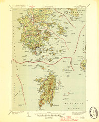
1944 Map of Deer Isle
USGS Topo · Published 1944About this map
Stonington and the southern reaches of Deer Isle anchor this 1940s coastal survey, revealing a landscape defined by its granite industry and maritime commerce. The map documents numerous Quarry sites and Quarries concentrated near West Stonington and the various islands of Merchant Row, reflecting the era's intensive stone extraction. Shoreline settlements like Sunset, Mountainville, and Sunshine are connected by a winding road network, while the interior is dotted with water bodies such as Lily Pond and Torrey Pond.
Find a feature on this map
212 named features on this map. Tap any name to fly to it.
Don’t see what you’re looking for? This feature index may not catch every label — zoom into the map to look around manually.
Map Details
Editions of this 1944 Deer Isle Map
2 editions found
Other maps of this area

1902 · Castine
USGS Topo · 1:62,500

1904 · Deer Isle
USGS Topo · 1:62,500

1904 · Castine
USGS Topo · 1:62,500

1904 · Mount Desert
USGS Topo · 1:62,500

1904 · Swan Island
USGS Topo · 1:62,500

1904 · Bluehill
USGS Topo · 1:62,500

1904 · Vinalhaven
USGS Topo · 1:62,500

1905 · Penobscot Bay
USGS Topo · 1:125,000

1906 · Matinicus
USGS Topo · 1:62,500

1941 · Castine
USGS Topo · 1:62,500