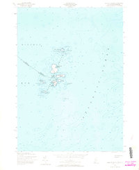
1956 Map of Isles of Shoals
USGS Topo · Published 1964About this map
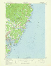
Appledore Island and its surrounding archipelago anchor this mid-century maritime study of the Isles of Shoals, straddling the border between York County, Maine, and Rockingham County, New Hampshire. The map documents a cluster of rocky outcrops in the Atlantic Ocean where history and geography are deeply intertwined, visible through commemorative markers like the Tucke Mon and Capt John Smith Mon on Star Island. These islands served as vital outposts for fishing and navigation for centuries, a role emphasized here by the Lighthouse on White Island and the shelter of Gosport Harbor.
Find a feature on this map
35 named features on this map. Tap any name to fly to it.
Don’t see what you’re looking for? This feature index may not catch every label — zoom into the map to look around manually.
Map Details
Editions of this 1956 Isles of Shoals Map
This is the sole edition of this map. No revisions or reprints were ever made.
Other maps of this area

1893 · York
USGS Topo · 1:62,500

1920 · York
USGS Topo · 1:62,500

1943 · Cape Ann
USGS Topo · 1:125,000
1944 · Kittery
USGS Topo · 1:24,000

1948 · Boston
USGS Topo · 1:250,000

1949 · Portland
USGS Topo · 1:250,000
1956 · Kittery
USGS Topo · 1:24,000
1956 · Isles Of Shoals
USGS Topo · 1:24,000
1956 · York
USGS Topo · 1:62,500

1956 · Portland
USGS Topo · 1:250,000