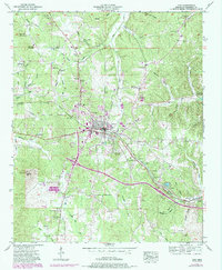
1953 Map of Iuka
USGS Topo · Published 1985About this map
Iuka serves as the central hub of this Northeast Mississippi landscape, where the Southern railroad line intersects with the Southern Highway. The town's layout features Mineral Springs Park at its heart, while the surrounding countryside is dotted with small rural communities like Oldham and Castleberry. This 1953 survey, updated with purple revisions in the early 1980s, captures the region's spiritual and social geography through numerous country churches, including Mt Joy Ch, Pleasant Hill Ch, and Mt Moriah Ch. To the southwest, Woodall Mtn stands as a prominent topographical landmark near the New Prospect Church. The map details an intricate drainage system where Cripple Deer Creek and Yellow Creek wind through the hills, supporting a network of family-named cemeteries such as Kirk Cem and Goyne Cem that provide invaluable data for local genealogists.
Find a feature on this map
66 named features on this map. Tap any name to fly to it.
Don’t see what you’re looking for? This feature index may not catch every label — zoom into the map to look around manually.
Map Details
Editions of this 1953 Iuka Map
3 editions found
Other maps of this area

1911 · Iuka
USGS Topo · 1:48,000

1914 · Iuka
USGS Topo · 1:62,500

1935 · Holcut
USGS Topo · 1:24,000

1935 · Doskie
USGS Topo · 1:24,000

1935 · Iuka
USGS Topo · 1:24,000

1935 · Leedy
USGS Topo · 1:24,000

1936 · Margerum
USGS Topo · 1:24,000

1936 · Waterloo
USGS Topo · 1:24,000

1936 · Shaws
USGS Topo · 1:24,000

1936 · Bishop
USGS Topo · 1:24,000