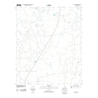
2010 Map of Ivan North
USGS Topo · Published 2010About this map
The Brazos River meanders through the northeastern corner of this Young County landscape, marking the distinct river curve at Brier Bend. Further south, Ball Mountain stands as a prominent topographical feature overlooking the drainages of Veale Creek and Duff Branch. The settlement of Ivan anchors the southwestern portion of the map at the junction of several rural routes including Ranch Rd 717.
Find a feature on this map
37 named features on this map. Tap any name to fly to it.
Don’t see what you’re looking for? This feature index may not catch every label — zoom into the map to look around manually.
Map Details
Editions of this 2010 Ivan North Map
This is the sole edition of this map. No revisions or reprints were ever made.
Other maps of this area

1890 · Breckenridge
USGS Topo · 1:125,000

1924 · Breckenridge 1-a
USGS Topo · 1:48,000

1924 · Graham 4-d
USGS Topo · 1:48,000

1924 · Breckenridge 1-d
USGS Topo · 1:48,000

1925 · Graham 4-c
USGS Topo · 1:48,000

1925 · Breckenridge 1-b
USGS Topo · 1:48,000

1927 · Graham
USGS Topo · 1:62,500

1931 · Ivan
USGS Topo · 1:62,500

1954 · Abilene
USGS Topo · 1:250,000

1954 · Wichita Falls
USGS Topo · 1:250,000